
Japan Real Estate Price Map — Real Property Transaction Prices on a Map
See what properties across Japan actually sold for. Transaction prices, official land prices, and appraisals are plotted as pins on an interactive map — search any address and check the local market in seconds.
Built on open data from Japan's Ministry of Land, Infrastructure, Transport and Tourism (MLIT).
Get on Google PlayWho It's For
- Buyers researching neighbourhood price levels before making an offer
- Overseas investors identifying areas in Japan worth a closer look
- Foreign residents in Japan considering a home purchase
- Owners wanting a sense of what nearby properties have sold for
- Professionals relocating between Japanese cities and comparing regions
- Analysts and agents who need raw transaction data in a visual form
Key Features
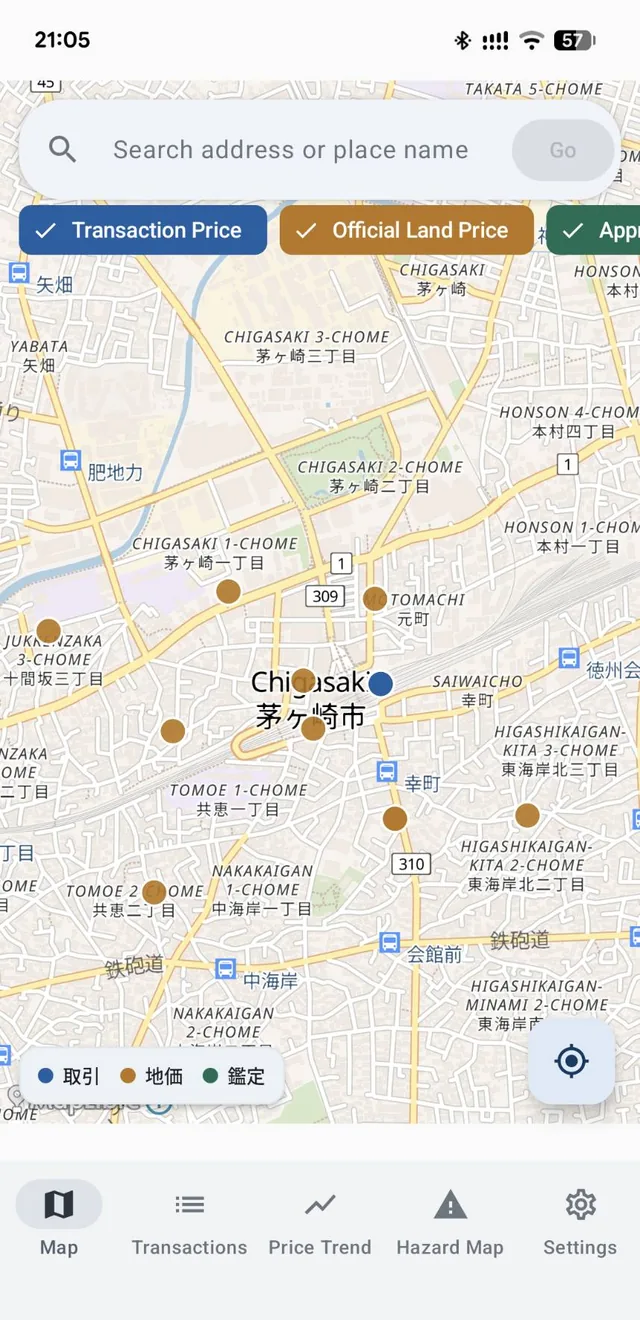
Map: © OpenStreetMap contributors
Three Price Layers, Switchable on One Map
Toggle between Transaction Price (what properties actually sold for), Official Land Price (the government's published benchmark for standard sites), and Appraisal values — all on the same map.
Seeing real sales alongside the official benchmark gives you a sense of how far actual prices sit from the published figures. You can also filter by land use.
Search by address or place name to jump straight to an area, or use the location button to see prices around you.
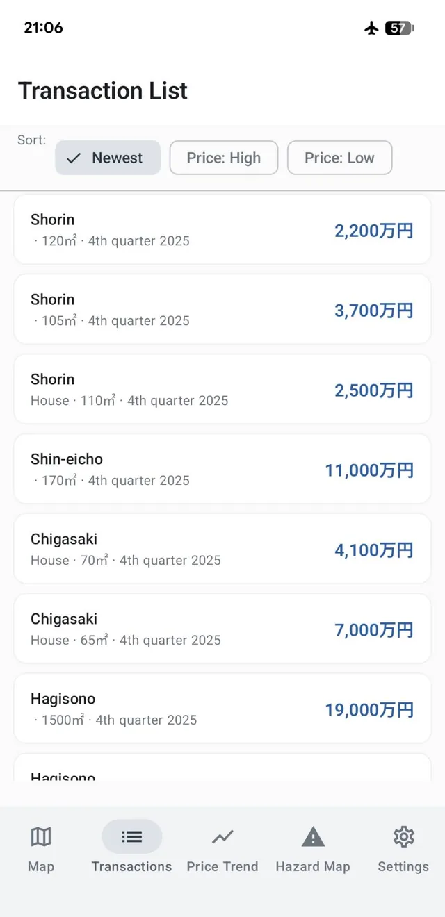
Transaction List for the Whole Area at Once
Every transaction in the area you're viewing, listed with its area name, use, size, period, and price — sortable by newest, highest price, or lowest price.
Faster than tapping pins one at a time when you want the overall price range.
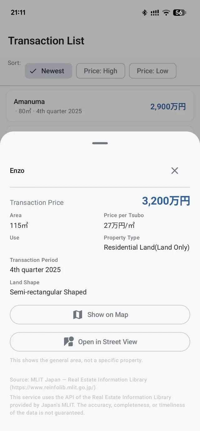
Detail Down to Price per Tsubo and Land Shape
Tap any transaction to see the price, area, price per tsubo, land use, property type (land only or land and building), transaction period, land shape, and building structure.
Two properties at the same headline price are rarely comparable — the per-unit figures are what let you compare them.
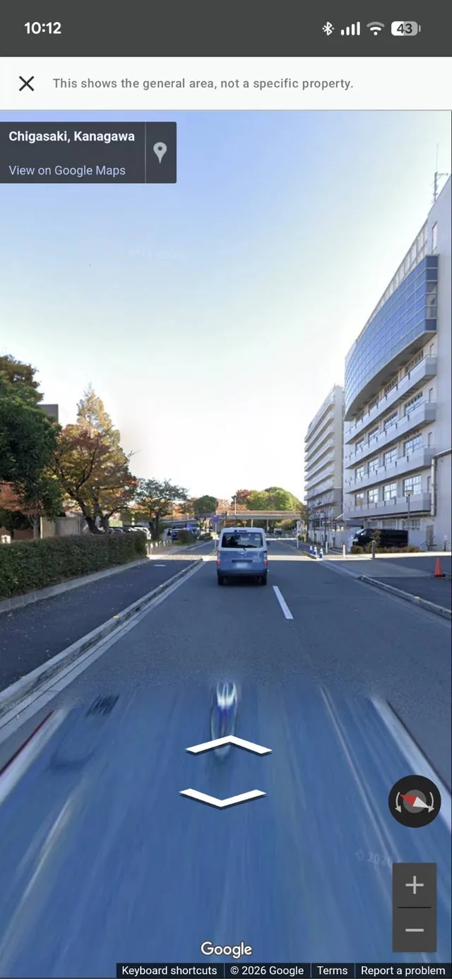
Street View to See What the Area Actually Looks Like
Open Street View directly from the detail screen to get a feel for road width, surroundings, and the general character of the neighbourhood — things a price alone won't tell you.
Note: this shows the general area, not a specific property.
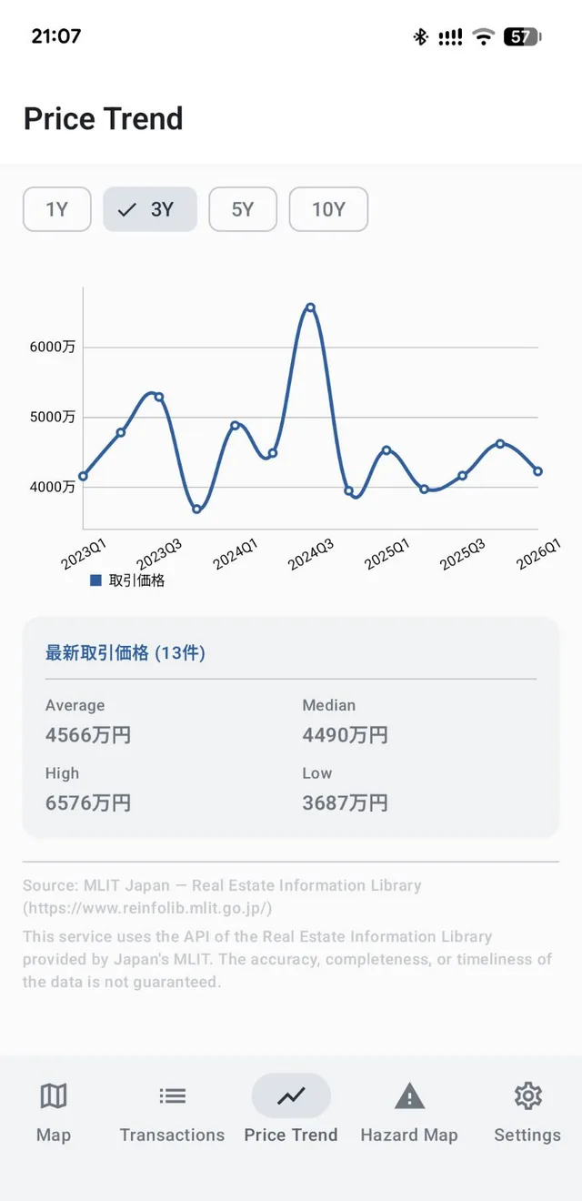
Price Trends Over 1, 3, 5, or 10 Years
Chart how transaction prices have moved in the area over your chosen period, with the average, median, high, and low figures and the number of transactions behind them.
A single sale tells you very little. The trend tells you where the market is going.
How to Use
- Install "Japan Real Estate Price Map" from Google Play.
- Open the app and type an address or place name into the search bar at the top of the map, then tap Go (or use the location button).
- Choose Transaction Price, Official Land Price, or Appraisal, and filter by land use if you want to narrow things down.
- Tap a pin on the map, or open the Transactions tab, to see the details of an individual sale.
- Open the Price Trend tab to see how prices in that area have moved over time.
Frequently Asked Questions
What's the difference between transaction prices and official land prices?
Official land prices (kōji chika) are benchmark values published annually by MLIT for designated standard sites, used as a reference for land transactions. Transaction prices are what properties actually sold for. This app lets you switch between both on the same map.
Does the app show rosenka (inheritance tax road ratings)?
No. Rosenka is published separately by Japan's National Tax Agency and is not included here. This app covers transaction prices, official land prices, and appraisals from MLIT's Real Estate Information Library.
Can I look up the price of a specific property?
No. The data is at an area level and does not identify individual addresses or properties. The same applies to the Street View imagery.
Can I use this for a property valuation?
Only as a reference. Displayed prices do not constitute an appraisal, valuation, or investment recommendation for any specific property. For a formal valuation, consult a licensed appraiser or agent.
Does the data cover every transaction in Japan?
No. MLIT's dataset is based on transactions where survey responses were obtained, so it does not represent every sale.
Does it cover all of Japan?
Yes, all 47 prefectures. The volume of data does vary by region and period.
Is it free?
Yes. The app is free and shows ads. There are no in-app purchases.
About the Data
This app uses the API of the Real Estate Information Library provided by Japan's Ministry of Land, Infrastructure, Transport and Tourism (MLIT). The accuracy, completeness, or timeliness of the data is not guaranteed.
The data is based on transactions where survey responses were obtained and does not represent every transaction in Japan. Displayed prices are for reference only and do not constitute an appraisal, valuation, or investment recommendation for any specific property.
Base map: © OpenStreetMap contributors
Specifications
| Supported OS | Android (Google Play checks compatibility with your device automatically on the install screen) |
|---|---|
| Languages | English, Japanese |
| Price | Free (contains ads, no in-app purchases) |
Try Japan Real Estate Price Map
Find out what the land around there actually sold for.
Get on Google Play 𝕏 Share